
Government of India’s Ministry of Road Transport & Highways, IIT Madras and MapmyIndia, India’s leading digital data and technology products and platforms company for maps, geospatial and location-based IoT, today signed an MoU for collaboration on driver and road safety technologies, and jointly launched India’s best and FREE-TO-USE navigation app service for all 130+ crore Indians.

The MapmyIndia, which won the Government of India’s Attmanirbhar App Innovation Challenge in 2020, additionally offers a myriad of mapping, navigation, safety and hyper-local features to help users in their day to day lives as they move around their city or across the country. The collaboration between MoRTH, IIT Madras and MapmyIndia represents the best of the public sector, academia and private sector coming together to offer a world-class, locally relevant, indigenous solution
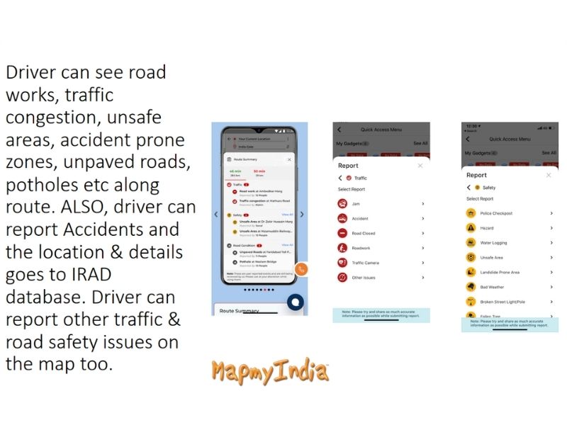
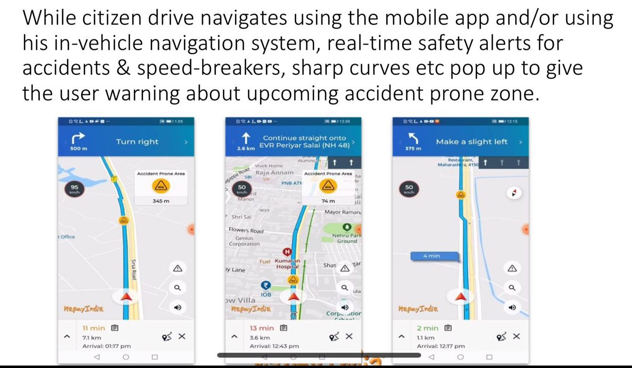
This is a truly Aatmanirbhar, Sarvottam Bharat initiative, and all Indians are encouraged to download and use the MapmyIndia app, and take benefit of these enhanced navigation and road safety alerts while driving. Further, all government organisations at central, state and local levels such as transport, public works, road and traffic departments and authorities are encouraged to use the app to report and broadcast information about accidents, poor traffic or road conditions, road works etc., so that users can be quickly alerted about potentially dangerous areas.
The free-to-use app can be downloaded by visiting mapmyindia.com/move.
Also Read: IIT Madras designs tech to detect earthquakes minutes before occurrence