


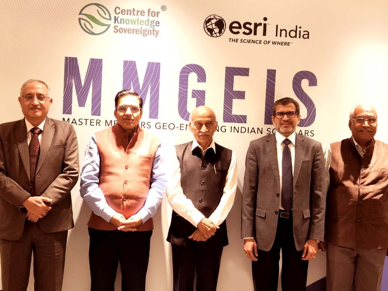
The Centre for Knowledge Sovereignty and Esri India, with mentors including former ISRO chairman A S Kiran Kumar have designed a program of Master Mentors Geo-enabling Indian scholars for students.
The pilot phase of the initiative will allow enrollment of over 1000 students across the country to inculcate in them a temperament for geospatial thinking and a research-oriented mindset.
This skill development program, which students can enroll for online, aims to engage up to 5,00,000 students between grade 8 and undergraduate students over the next five years. The pilot phase will train school going students and a wider implementation is scheduled for June.
Agendra Kumar, Managing Director, Esri India, said, “By equipping students with geospatial awareness and skills, we believe they will be well-prepared to tackle the challenges of the future and make a positive impact on society.”
Meanwhile, at the launch, A S Kiran Kumar said, “The idea is to explain the technology to students and help them understand how they can use it in real life scenarios to solve problems. Today what is happening in the country is that the products consumed are developed elsewhere. For instance, when we buy a mobile phone, a part of the money goes abroad as they own technology patents. The same must not happen in future.”
Kumar said that while the study material is available only in English currently, they hope to translate it to vernacular languages to be able to reach more students.
Curriculum and pedagogy
The free of cost program has been divided into two courses. The first targets classes 8 to 12 while the other is for undergraduates.
The 4-month-long program will be offered to a select few students who can apply online. Course material in the form of audio-visual information will be offered to students following which an assessment will be conducted.
Students will be given study material in the form of videos spanning between 12-20 minutes each. A team will correspond either via emails or chats to respond to students for clarification.
Program structure
For school students
1: Basics: Basics of spatial analysis
2: Mentorship: Technology integration-a transformative tool
3: Master mentorship: GIS for improving the lives, understanding intellectual property
For undergraduate students
In addition to the above modules, the fourth will involve a Project (Thinking problem solving)
Posted in Corporate, News